Airport Runway Markings, Signs and More
Every day, aircraft of all shapes and sizes take off from and land on an airport runway. Runways are built to accommodate and guide pilots, using visual aids to ensure safe operation. Have you ever considered how it is runways are arranged or what the different markings, signs and layouts mean? Let’s examine these runway components and how they help pilots to maneuver safely and efficiently.
Airport Runway Markings
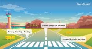
There are different airport runway markings used to provide pilots with directions and to assist them operationally. Markings for runways are white, while taxiway markings, areas not intended for aircraft use and holding positions are yellow.
- Runway Centerline Markings: The centerline of a runway provides alignment guidance for taking off and and landing. It consists of a line of 120-foot stripes and 80-foot gaps.
- Runway Aiming Point Marking: The aiming point marking is used for a landing airplane. There are two rectangular markings with a large white stripe on either side of the runway centerline about 1,000 feet from the landing threshold.
- Runway Touchdown Zone Markers: These markings pinpoint the touchdown for landing operations and are coded to provide distance information. These markings are grouped into one, two and three rectangular bars arranged in pairs about the centerline.
- Runway Side Stripe Marking: Runway side stripe markings are white markings outlining the edges of a runway.
- Runway Shoulder Markings: Runway shoulder stripes may be used to supplement runway side stripes. This identifies pavement areas neighboring the runway side that are not intended for airplane use.
- Runway Threshold Bar: A threshold bar presents the beginning of the runway available for landing if the threshold has been relocated or displaced. This bar is 10 feet wide and extends across the runway’s width.
- Runway Threshold Markings: Runway threshold markings come in two layouts. These markings are either eight stripes placed symmetrically about the runway centerline, or the number of stripes is related to the runway’s width.
- Displaced Threshold: A displaced threshold is located at a point on the runway other than the beginning of the runway. White arrows are located along the centerline in the area between the beginning of the runway and displaced threshold. White arrowheads are situated across the width of the runway before the threshold bar.
- Runway Holding Position Markings: These markings are used only if the runway is normally used by ATC for “land and hold short” or taxiing operations and are important for those operations. A sign with white lettering on a red background is placed adjacent to these holding position markings. Holding position markings are placed on runways prior to the intersection with another runway, or another point.
Airport Runway Signs
While airport runway markings are painted on the surface of a runway, signs can either be vertical or painted on the surface as well. Looking at an airport runway, you’ll notice there are signs just about everywhere. What is the significance of each?
Types of signs include:
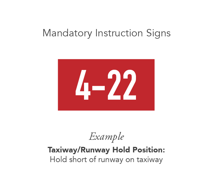
- Mandatory Instruction Signs: These airport signs have a red background with white lettering and indicate an entrance to a runway, critical area or prohibited area.
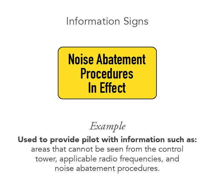
- Information Signs: Information signs have a yellow background with black writing. They provide pilots with information on things that cannot be seen from the control tower, applicable radio frequencies and noise lessening procedures.
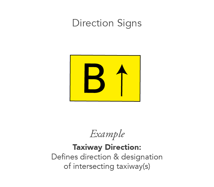
- Direction Signs: Direction signs have a yellow background with black writing. The black writing identifies the designation of the intersecting taxiway(s) leading out of an intersection.
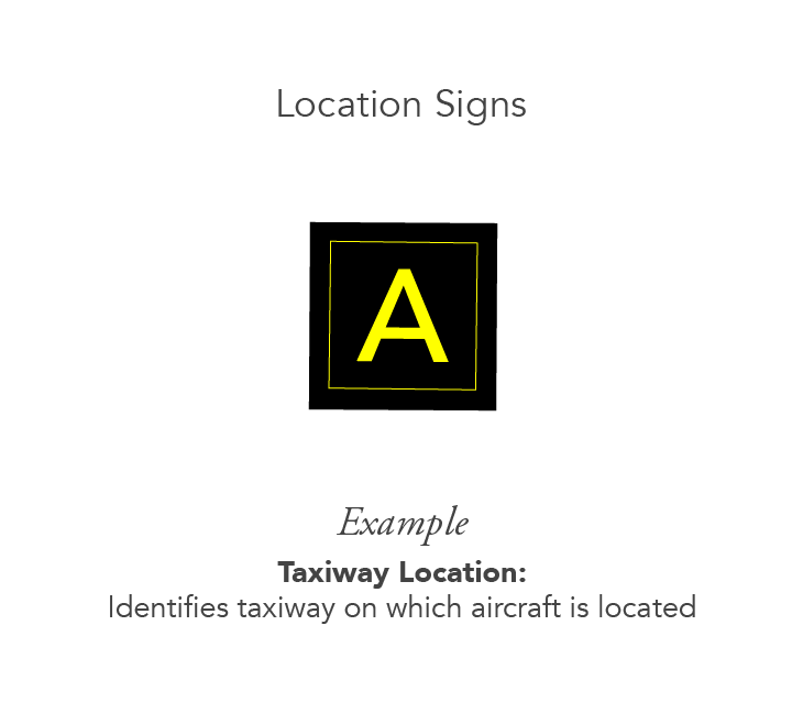
- Location Signs: These signs are used to pinpoint a taxiway or airport runway location, the boundary of the runway or an instrument landing system critical area. Location signs are black with yellow lettering, a yellow border and no arrows.
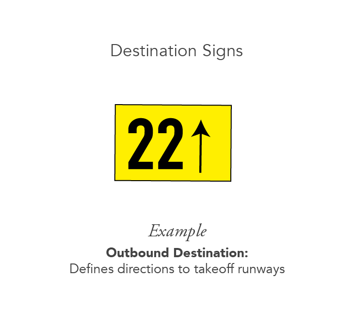
- Destination Signs: Destination signs have a yellow background, black inscription and contain arrows. These signs provide information on locating terminals, runways, civil aviation areas and cargo areas.
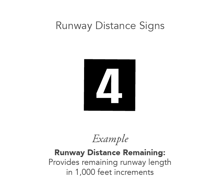
- Runway Distance Remaining Signs: Runway distance remaining signs have a black background and white numbers. The numbers show the distance of the remaining runway in thousands of feet.
Some airports can be more complex than others, so it’s important for pilots to pay close attention to each sign.
Airport Runway Numbering
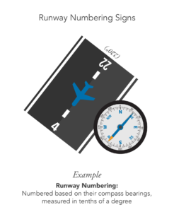
Runways are numbered based on their compass bearings, measured in tenths of a degree. Imagining a compass, 360 represents north, 90 represents east, 180, south and 270 denotes west. Runways are numbered between 01 and 36, and to identify a runway, the zero is dropped from the magnetic heading the runway is facing. For instance, a west-facing runway with a heading of 270 degrees translates to runway 27 and so on.
To ensure operations are properly followed, airports employ the same runway numbering structure.
A runway going East to West works in both directions depending on which way the wind is blowing. It is therefore 2 runways, 9 and 27. All runways are numbered using 2 numbers, 18 apart because of 180-degree difference.
Airports that have parallel runways going in the same direction are designated as “L” for left and “R” for right. In the case of three runways, a “Center” is included. If there are four or more runways, an airport will change the numbers for differentiation.
Airport Runway Layouts
Basic airport runway layout examples include:
- Single Runways: Single runways are positioned so that aircraft can utilize prevailing winds in the area.
- Parallel Runways: Parallel runways are spaced a certain number of feet apart depending on the size and number of the planes using them. Airports offer parallel runways so that airplanes can land on one runway while another aircraft can depart from the second runway. These runways are used if the winds are consistently blowing from the same direction.
- Intersecting Runways: Intersecting runways cross according to prevailing winds that change throughout the year. These runways can intersect at a variety of points. Land and hold short operations (LAHSO) occur at intersecting runways for the purpose of increasing airport capacity without causing safety issues. An aircraft lands and “holds short” of an intersecting runway point.
- Open-V Runways: Open-V runways diverge from different directions and do not intersect, forming a “V” shape. Each runway can be used at the same time if little to no wind is present. However, when there are strong winds coming from one direction, the runway that allows aircraft to take off into the wind will be the airport runway in use.
Though there are multiple ways in which they’re arranged, airport runways are oriented to assist in takeoffs and landings.
Runways Across Different Airports
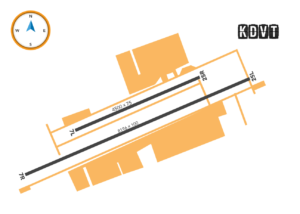
Deer Valley Airport (KDVT)
The Deer Valley Airport provides parallel runways. This allows opportunity for double the amount of aircraft and operations, since both runways can be in use at the same time.
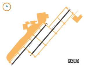
Chandler Municipal Airport (KCHD)
Like KDVT, the Chandler Municipal Airport also offers parallel runways to accommodate traffic as necessary. However, the runways are rotated by a couple of degrees in comparison to Deer Valley.
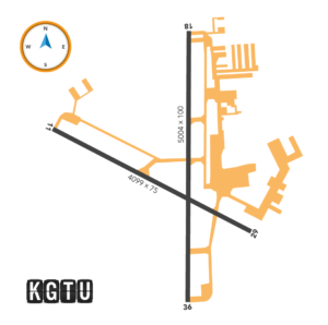
Georgetown Municipal Airport (GTU)
At the Georgetown Municipal Airport, pilots are provided parallel and intersecting runways. Students primarily utilize the parallel runways, unless the winds are very strong.
Airport runways are designed based on traffic, and the kinds of planes that fly there. At AeroGuard’s multiple locations, students are provided with a variety of airport runway layouts for practicing.